Big Mike
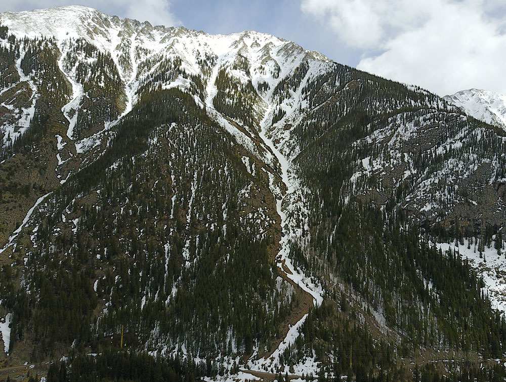
This is a huge, steep, dangerous N-NW-W facing gully off Tenmile Peak that goes down to the bike path on I-70. There are multiple skiable lines that all funnel into the same main drainage. This adds many different aspects that can slide above you, all with different amounts of sun heating and wind loading. Some of the lines could be down-hiked from Tenmile Peak, but most people would choose to climb up from the bike path to ensure the line is filled in. When rock chokes melt out you can get cliffed out or swept into rocks by loose snow. Watch out for cornice formation at the top of certain lines. This entire zone should be considered extremely dangerous.
Maps
*All Mapped Areas are Approximations
Avalanche Reports
04/30/2020 - (Multiple Reports)
02/24/2020 - (Multiple Reports)
02/13/2020 - (Multiple Reports)
Images
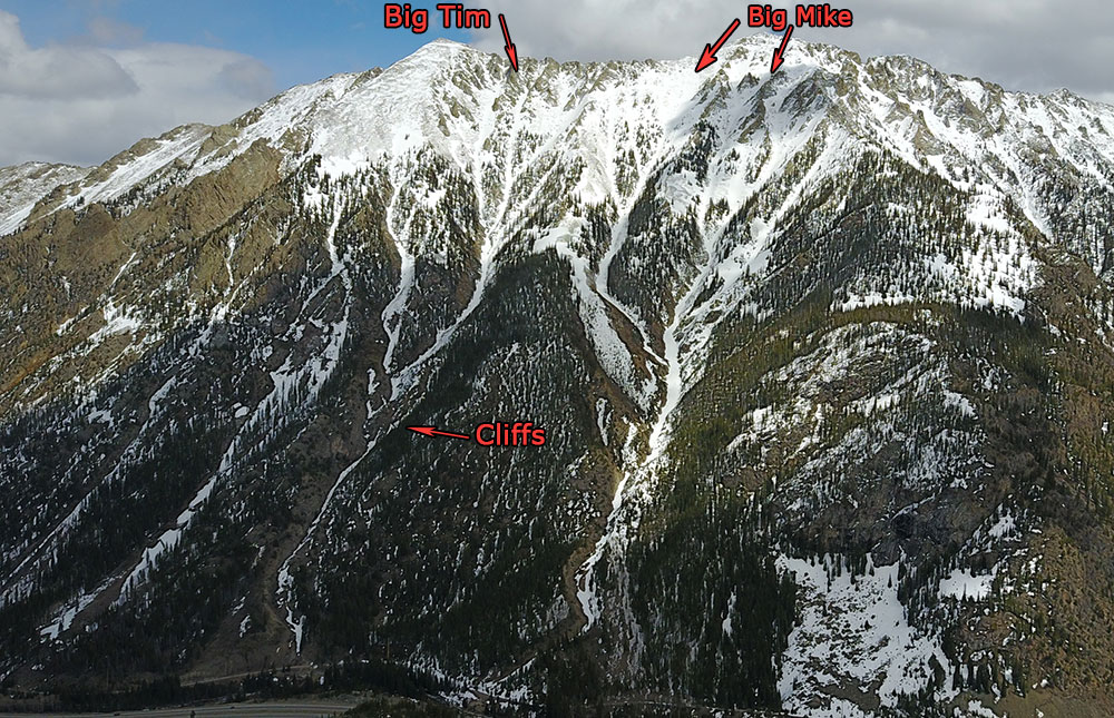
Big Tim and Big Mike
Big Mike Gully
Guide Books
Making Turns in The Tenmile-Mosquito Range by Fritz Sperry
(Links to guidebooks may be affiliate links)
Find Nearby Zones
*All Mapped Areas are Approximations